Smart Geospatial Strategies for Businesses: Unlocking the Power of Location Data
- Nathan Kitts

- May 22
- 3 min read
In today’s fast-paced world, making smart decisions about where and how to deploy your teams and resources can make all the difference. Whether you manage field personnel, sales teams, or law enforcement units, understanding the geography of your operations is key to boosting efficiency and revenue. This is where geospatial strategies come into play. By leveraging location-based data, you can optimize territory assignments, improve workload distribution, and respond faster to changing conditions.
Let’s explore how you can use geospatial intelligence insights to transform your organization’s approach to resource management and decision-making.
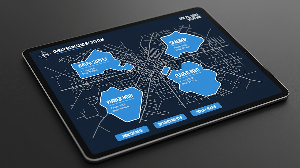
How Geospatial Strategies Benefit Your Business
Geospatial strategies involve analyzing geographic data to gain insights that help you make better decisions. When you apply these strategies, you can:
Optimize routes and territories: Assign your teams to areas where they can be most effective, reducing travel time and costs.
Improve workload balance: Distribute tasks evenly across your workforce to avoid burnout and increase productivity.
Enhance situational awareness: Monitor real-time conditions such as traffic, weather, or incidents to adjust plans quickly.
Identify growth opportunities: Spot underserved areas or emerging markets to expand your reach strategically.
For example, a sales manager can use geospatial data to divide a city into zones that maximize customer coverage while minimizing overlap. Similarly, law enforcement agencies can deploy officers more efficiently by analyzing crime hotspots and response times.
By integrating geospatial strategies into your operations, you gain a competitive edge through smarter, data-driven decisions.

Implementing Geospatial Strategies for Businesses
To get started with geospatial strategies, follow these practical steps:
Collect accurate location data
Gather data from GPS devices, mobile apps, or geographic information systems (GIS). Ensure the data is current and precise.
Analyze your operational areas
Use mapping tools to visualize your territories, routes, and resource locations. Look for patterns such as high-demand zones or traffic bottlenecks.
Define clear objectives
Decide what you want to achieve—whether it’s reducing travel time, increasing customer visits, or improving emergency response.
Assign resources strategically
Based on your analysis, allocate personnel and assets to areas where they can deliver the most value.
Monitor and adjust continuously
Use real-time data feeds to track performance and make adjustments as conditions change.
By following these steps, you can create a dynamic system that adapts to your organization’s needs and maximizes efficiency.

Leveraging Geospatial Intelligence Insights for Smarter Decisions
The phrase geospatial intelligence insights refers to the valuable knowledge you gain by analyzing geographic data in context. These insights help you understand not just where things are, but why they are there and how they interact.
For example, by combining demographic data with location information, you can identify neighborhoods with high potential for sales growth. Or, by overlaying traffic patterns with service requests, you can optimize dispatch routes for faster response times.
To leverage these insights effectively:
Use visualization tools like heat maps and layered maps to see complex data clearly.
Integrate geospatial data with your existing business intelligence systems.
Train your teams to interpret and act on location-based information.
Collaborate across departments to share geospatial findings and align strategies.
By embedding geospatial intelligence insights into your decision-making process, you create a smarter, more responsive organization.
Best Practices for Maximizing Geospatial Strategy Impact
To ensure your geospatial strategies deliver real results, keep these best practices in mind:
Prioritize data quality: Inaccurate or outdated data can lead to poor decisions. Regularly update and validate your datasets.
Focus on user-friendly tools: Choose mapping and analysis software that your teams can easily adopt and use.
Encourage cross-functional collaboration: Share geospatial insights across departments to foster unified strategies.
Measure outcomes: Track key performance indicators such as reduced travel time, increased coverage, or faster response rates.
Stay adaptable: Geospatial conditions change rapidly. Be ready to adjust your plans based on new data.
By following these guidelines, you’ll build a robust geospatial strategy that drives efficiency and growth.
Smart geospatial strategies empower you to make informed, data-driven decisions that optimize how you deploy your people and resources. Whether you’re managing sales territories, field operations, or public safety teams, leveraging location data can transform your approach and boost your organization’s performance.
Start exploring geospatial intelligence insights today and unlock the full potential of your operations.


Comments