Revolutionizing Business with Business Geospatial Solutions
- Nathan Kitts

- Jun 24
- 3 min read
In today’s fast-paced world, making smart decisions about where and how to deploy your people and resources is crucial. You need tools that help you understand your environment better and act faster. Business geospatial solutions offer exactly that - a way to visualize, analyze, and optimize your operations using location-based data. This technology is transforming how organizations manage field personnel, sales teams, and law enforcement agencies by providing clear insights that drive efficiency and revenue growth.
How Business Geospatial Solutions Transform Operations
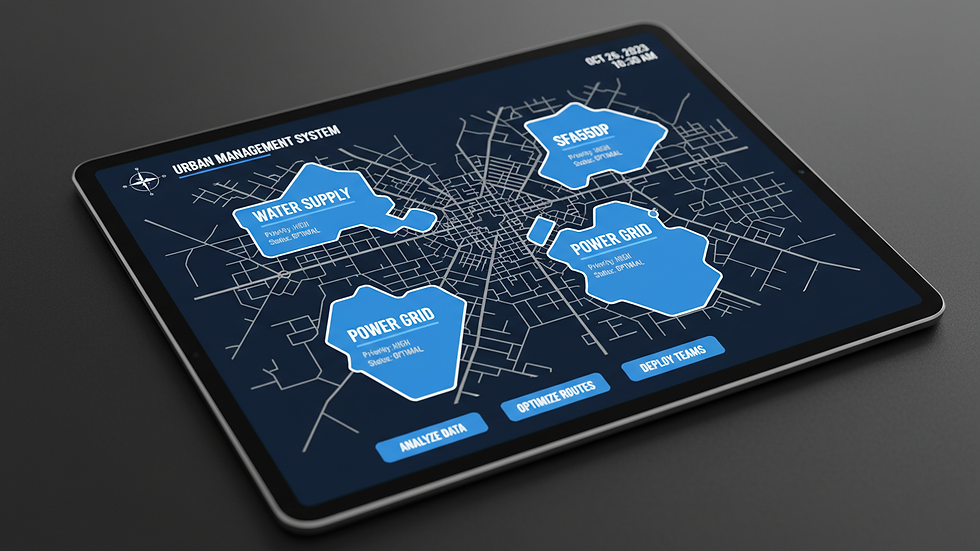
Business geospatial solutions help you see the bigger picture by mapping out your assets, customers, and territories. Imagine having a detailed map that shows where your teams are, where demand is highest, and where resources are stretched thin. This kind of visibility allows you to:
Optimize routes and schedules to reduce travel time and costs.
Balance workloads by assigning tasks based on geographic proximity and team capacity.
Identify new market opportunities by analyzing customer distribution and competitor locations.
Enhance safety and response times for law enforcement by tracking incidents and patrol routes.
For example, a sales manager can use geospatial data to assign territories that maximize coverage and minimize overlap. A field service team can plan routes that avoid traffic congestion and reduce fuel consumption. Law enforcement agencies can deploy officers more strategically based on crime hotspots and historical data.

Leveraging Geospatial Intelligence Insights for Smarter Decisions
When you integrate geospatial intelligence insights into your business processes, you gain a powerful advantage. These insights combine geographic data with analytics to reveal patterns and trends that are not obvious at first glance. This means you can:
Predict where demand will spike and prepare accordingly.
Detect inefficiencies in resource allocation and correct them quickly.
Monitor real-time changes in the field to adapt your strategy on the fly.
Improve communication and coordination among dispersed teams.
For instance, a logistics company might use geospatial intelligence to forecast delivery delays caused by weather or road closures. A law enforcement agency could analyze crime data to deploy officers proactively rather than reactively. These insights help you stay ahead of challenges and seize opportunities before your competitors do.
What MOS is 35G?
In the context of geospatial intelligence and military operations, MOS 35G refers to a Military Occupational Specialty focused on Geospatial Intelligence Imagery Analyst. These specialists analyze imagery and geospatial data to provide actionable intelligence. Their work supports decision-making by interpreting satellite images, maps, and other geospatial information to identify threats, terrain features, and other critical factors.
Understanding the role of MOS 35G highlights the importance of geospatial intelligence in high-stakes environments. While this is a military designation, the principles of analyzing and applying geospatial data are equally valuable in business settings. You can learn from these experts by adopting similar analytical techniques to improve your operational planning and resource management.
Practical Steps to Implement Business Geospatial Solutions
If you want to revolutionize your operations with geospatial technology, here are some actionable steps to get started:
Assess Your Needs - Identify the key challenges your teams face in the field. Is it inefficient routing, poor territory management, or slow response times?
Gather Relevant Data - Collect geographic data related to your assets, customers, and operational areas. This might include GPS coordinates, customer addresses, and historical performance data.
Choose the Right Tools - Select geospatial software that fits your budget and technical capabilities. Look for solutions that offer easy integration with your existing systems.
Train Your Teams - Ensure your staff understands how to use geospatial tools effectively. Provide training sessions and create user-friendly guides.
Analyze and Act - Use the insights gained to optimize routes, balance workloads, and improve decision-making. Monitor results and adjust your strategies as needed.
By following these steps, you can unlock the full potential of business geospatial solutions and see tangible improvements in efficiency and revenue.

Driving Growth and Efficiency with Location Intelligence
Incorporating location intelligence into your business strategy is no longer optional - it’s essential. When you harness the power of geospatial data, you gain a competitive edge that helps you:
Boost revenue by targeting high-potential areas and optimizing sales territories.
Increase operational efficiency by reducing travel time and balancing workloads.
Enhance customer satisfaction through faster service and better resource allocation.
Improve safety and compliance by monitoring field activities and responding quickly to incidents.
PureSynergy Consulting aims to be your partner in this journey. By helping you make smart, data-driven decisions about deploying your people and resources, you can transform your business operations. The future belongs to those who understand the power of location and use it to their advantage.
Start exploring business geospatial solutions today and watch your organization thrive.


Comments