How Combining Intelligence Analysis, Geospatial Insights, and PMI Project Management Boosts Your Strategic Projects
- Nathan Kitts

- May 28
- 4 min read

When you manage complex projects, especially those involving field personnel, sales teams, or law enforcement, you need more than just a plan. You need clear intelligence, precise location data, and a proven way to keep everything on track. Combining intelligence analysis, geospatial insights, and project management based on PMI’s principles gives you a powerful edge. This approach helps you make smarter decisions, allocate resources better, and deliver results faster.
PureSynergy Consulting stands out by blending these three areas with a unique skill set. We help organizations like yours tackle strategic projects and initiatives with confidence and clarity. Let’s explore how this combination works and why it matters for your success.
Why Intelligence Analysis Matters in Project Success
Intelligence analysis is about gathering and understanding information that affects your project. It helps you spot risks, opportunities, and trends before they become obvious. When you use intelligence analysis, you get a clearer picture of the environment your project operates in.
For example, if your sales team is expanding into a new region, intelligence analysis can reveal customer preferences, competitor moves, and potential challenges. This insight lets you adjust your strategy early, saving time and money.
Intelligence analysis also supports better communication. When your team understands the “why” behind decisions, they stay motivated and aligned. This reduces confusion and keeps everyone moving toward the same goal.
How Geospatial Insights Improve Resource Deployment
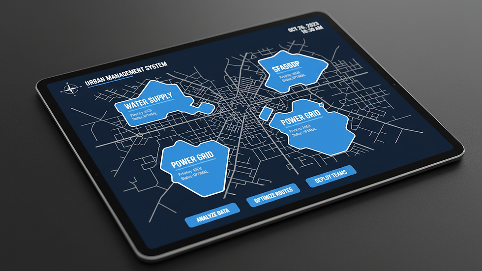
Geospatial insights add a location-based layer to your project data. They show where your people, assets, and customers are, and how they interact with the environment. This is especially useful for organizations with field personnel or law enforcement teams.
Imagine you need to assign patrols or sales visits efficiently. Geospatial data helps you map territories, identify high-priority areas, and balance workloads. This reduces travel time, cuts costs, and improves coverage.
PureSynergy Consulting uses geospatial insights to optimize territory and workload distribution. This means your teams spend more time where they matter most, boosting productivity and results.
Using PMI’s Project Management Standards to Keep Projects on Track
The Project Management Institute (PMI) offers a set of proven approaches, principles, and standards that guide project delivery. These include clear processes for planning, executing, monitoring, and closing projects.
By following PMI standards, you reduce risks and improve predictability. You know what to expect at each stage and how to handle changes. This structure supports better decision-making and keeps your project aligned with business goals.
PMI’s focus on stakeholder engagement ensures everyone involved understands their role and responsibilities. This clarity helps avoid delays and misunderstandings.
How PureSynergy Consulting Combines These Elements
PureSynergy Consulting brings together intelligence analysis, geospatial insights, and PMI project management in a way few others do. This combination creates a full picture of your project environment, resources, and progress.
For example, when working with law enforcement agencies, PureSynergy uses intelligence analysis to identify crime hotspots. Then, geospatial tools map patrol routes and resource locations. Finally, PMI methods guide the project from planning to execution, ensuring goals are met on time.
This approach also applies to sales teams and field operations. PureSynergy’s expertise helps you deploy your people and resources smartly, improving efficiency and boosting revenue.
Examples of Services That Support This Approach
PureSynergy offers services that naturally fit this combined approach. One example is their Territory and Workload Optimization service. This service uses geospatial data and intelligence analysis to balance workloads and assign territories effectively. It follows PMI standards to manage the project smoothly from start to finish. You can learn more about it here.
Another service is Strategic Project Management Consulting. This service helps organizations apply PMI principles to complex projects, integrating intelligence and geospatial insights for better outcomes. Details are available here.
These services show how PureSynergy’s unique skill set delivers real value by combining data, location, and project management.

Benefits You Gain from This Integrated Approach
Better Decision Making
You get clear, data-driven insights from intelligence and geospatial analysis. This helps you choose the best strategies and avoid costly mistakes.
Improved Resource Use
Geospatial insights let you assign people and assets where they are needed most. This reduces waste and increases productivity.
Stronger Project Control
PMI standards give you a clear roadmap and tools to manage risks, changes, and communication. Your projects stay on track and meet goals.
Faster Response to Changes
With real-time intelligence and location data, you can adjust plans quickly when conditions change.
Higher Team Alignment
Everyone understands the plan, their role, and the reasons behind decisions. This keeps teams motivated and focused.
How This Approach Supports Your Business Goals
PureSynergy Consulting’s approach aligns perfectly with your goal to make smart, data-driven decisions about deploying people and resources. By combining intelligence analysis, geospatial insights, and PMI project management, you can:
Optimize territory and workload distribution
Boost revenue through better coverage and efficiency
Reduce operational costs by cutting unnecessary travel and effort
Deliver projects on time and within budget
Improve overall organizational performance
This integrated method turns complex projects into manageable, successful initiatives.

Next Steps to Take
Start by assessing your current project management and resource deployment methods. Look for gaps where intelligence or geospatial data could add value. Consider working with experts who understand how to combine these areas effectively.
PureSynergy Consulting offers tailored solutions that fit your needs. Their expertise can help you build a stronger foundation for your strategic projects and initiatives.
Explore their services and see how this unique approach can help you get more from your teams and resources.
By combining intelligence analysis, geospatial insights, and PMI project management, you gain a clear advantage in managing complex projects. PureSynergy Consulting’s unique skill set helps you make better decisions, deploy resources wisely, and deliver results that matter. This approach supports your goals to boost revenue and efficiency through smart, data-driven strategies.
Take the next step to improve your project outcomes by integrating these powerful tools and methods today.


Comments